F: 1947.25
Menlough Village, Lough Corrib, Co. Galway, 1945: Architectural Drawings of Irish Traditional Houses
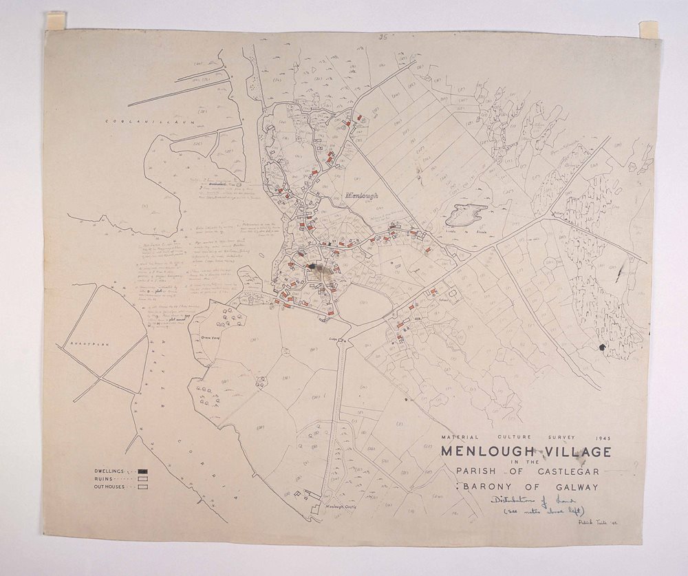
County Galway, Menlough - Map of village plotting houses and land
Surveyed by Patrick Tuite, 1945. Wove paper, black printing ink, pencil annotations, red and black ink. Height 503mm, Width 595mm.
This is a hand drawn annotated map of Menlough Village, on the River Corrib, County Galway in 1945. The map plots houses with their associated land ownership.
The various households held separate pieces of land over a wide area. This pattern of dispersed land ownership evolved from earlier centuries when Rundale - a communal farming system - was practiced. In the Rundale system fields near clustered housing were divided into tillage strips of good and poor land. These strips were marked but not physically separated. Each strip was divided among the families of the village and also rotated on occasion.
Location:
Menlough Village, Lough Corrib, Co. Galway, 1945: Architectural Drawings of Irish Traditional Houses is located at:
In Storage
Previous artefact:
Menlough Village, Lough Corrib, Co. Galway, 1945: Architectural Drawings of Irish Traditional Houses
Next artefact: